 The True Size of Poland
Compare Poland with other countries and regions on an interactive map to see their actual relative sizes.
Search countries
Type a country name and press Enter to add it to the map.
How big is Poland?
Poland covers about 312,685 km² (120,728 sq mi). On a Mercator map its apparent size depends entirely on latitude — drag the outline above onto another part of the world to see how it really compares.
Poland on a Mercator map
The centre of this country lies at 52° N, where the Mercator projection stretches area by about 2.6×. Its outline takes up as much room on the map as 828,520 km² would at the equator.
Its real area is 312,685 km². The country closest to that size: Oman.
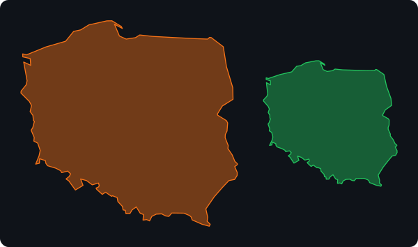
Poland compared with other countries
Total areas including inland water; ratios are rounded.
| Country | Area (km²) | Compared with Poland |
|---|---|---|
 Russia Russia | 17,098,242 | 55× larger |
 Canada Canada | 9,984,670 | 32× larger |
 United States United States | 9,833,517 | 31× larger |
 China China | 9,596,960 | 31× larger |
 Brazil Brazil | 8,515,770 | 27× larger |
 Australia Australia | 7,741,220 | 25× larger |
 India India | 3,287,263 | 11× larger |
 Argentina Argentina | 2,780,400 | 8.9× larger |
 Greenland Greenland | 2,166,086 | 6.9× larger |
 Mexico Mexico | 1,964,375 | 6.3× larger |
 Indonesia Indonesia | 1,904,569 | 6.1× larger |
 Pakistan Pakistan | 796,095 | 2.5× larger |
 France France | 643,801 | 2.1× larger |
 Ukraine Ukraine | 603,550 | 1.9× larger |
 Japan Japan | 377,915 | 1.2× larger |
 New Zealand New Zealand | 268,838 | 1.2× smaller |
 United Kingdom United Kingdom | 243,610 | 1.3× smaller |
 Netherlands Netherlands | 41,543 | 7.5× smaller |