 The True Size of Indonesia
Compare Indonesia with other countries and regions on an interactive map to see their actual relative sizes.
Search countries
Type a country name and press Enter to add it to the map.
How big is Indonesia?
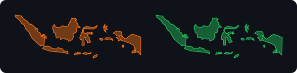
Indonesia covers about 1,904,569 km² (735,358 sq mi). On a Mercator map its apparent size depends entirely on latitude — drag the outline above onto another part of the world to see how it really compares.
Indonesia on a Mercator map
The centre of this country lies at 2° S, almost on the equator, where Mercator distorts least of all. The map shows it at very nearly its real size, which almost no country further north or south can claim.
Its real area is 1,904,569 km². The country closest to that size: Sudan.
Indonesia compared with other countries
Total areas including inland water; ratios are rounded.
| Country | Area (km²) | Compared with Indonesia |
|---|---|---|
 Russia Russia | 17,098,242 | 9× larger |
 Canada Canada | 9,984,670 | 5.2× larger |
 United States United States | 9,833,517 | 5.2× larger |
 China China | 9,596,960 | 5× larger |
 Brazil Brazil | 8,515,770 | 4.5× larger |
 Australia Australia | 7,741,220 | 4.1× larger |
 India India | 3,287,263 | 1.7× larger |
 Argentina Argentina | 2,780,400 | 1.5× larger |
 Greenland Greenland | 2,166,086 | 1.1× larger |
 Mexico Mexico | 1,964,375 | about the same |
 Pakistan Pakistan | 796,095 | 2.4× smaller |
 France France | 643,801 | 3× smaller |
 Ukraine Ukraine | 603,550 | 3.2× smaller |
 Japan Japan | 377,915 | 5× smaller |
 Poland Poland | 312,685 | 6.1× smaller |
 New Zealand New Zealand | 268,838 | 7.1× smaller |
 United Kingdom United Kingdom | 243,610 | 7.8× smaller |
 Netherlands Netherlands | 41,543 | 46× smaller |